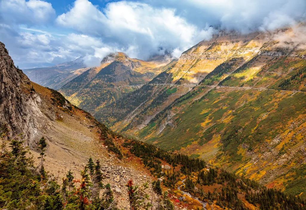

There is a place in northwest Montana where the mountains fold into each other so sharply they seem to have been pressed from above. Glacier National Park sits at that fold, and for generations it was defined by ice. Hundreds of glaciers stretched across its ridgelines, coloring every photograph in blue-white and carved stone. That image is now a document of something that is actively disappearing, frame by frame, decade by decade.
What makes this particular story so striking is the speed. Not the geological speed of a warming epoch, but the speed of a single human lifetime. People alive today first visited a park flush with ice and return to find exposed rock where glaciers once pressed. This is what a visual timeline of Glacier National Park actually shows us – not gradual change, but transformation in fast motion.
The Park at Its Founding – 1910
It has been estimated that there were approximately 150 glaciers present in 1850, and most glaciers were still present in 1910 when the park was established. The park was, in many ways, named for exactly what it held. Indigenous people have referred to the Glacier National Park area as “the place where there is a lot of ice,” while other tribes described the park as “the land of the shining mountains” because of the bright, reflective snow and ice seen from the plains to the east.
While the glaciers that carved the park’s majestic peaks were part of a glaciation that ended about 12,000 years ago, the current glaciers are considered geologically new, having formed about 7,000 years ago. These glaciers grew substantially during the Little Ice Age, which began around 1400 A.D. and reached their maximum size at the end of that period around 1850. The park in 1910 was, in other words, still near that peak – a vast frozen archive pressed into the Rockies.
The First Surveys – Mapping What Was There
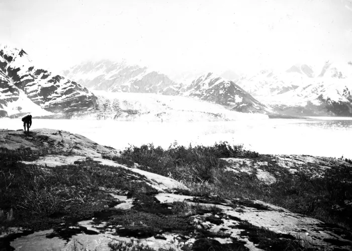
Once Glacier National Park was established in 1910, the U.S. Geological Survey began sending William C. Alden on annual expeditions into the park to survey and map its glaciers and topography. In 1914, USGS published Alden’s report, “The Glaciers of Glacier National Park.” Those early surveys gave scientists a fixed baseline they would return to, again and again, as the ice began to contract.
USGS scientists have studied these glaciers since the late 1800s, building a body of research that documents widespread glacier change over the past century. Ongoing USGS research pairs long-term data with modern techniques to advance understanding of glacier physical processes, alpine ecosystem impacts, and climate linkages. The paper maps and glass-plate photographs from those early expeditions are now among the most valuable scientific documents the park holds.
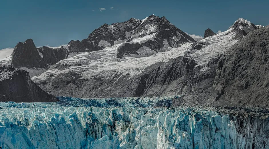
Grinnell Glacier – The Face of Loss
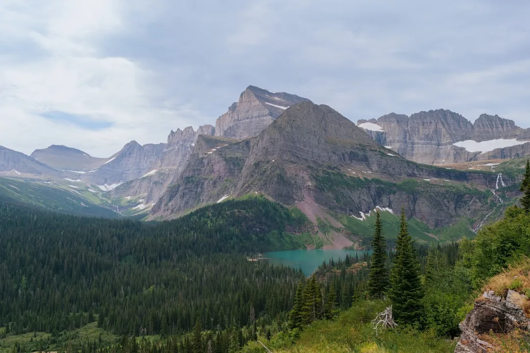
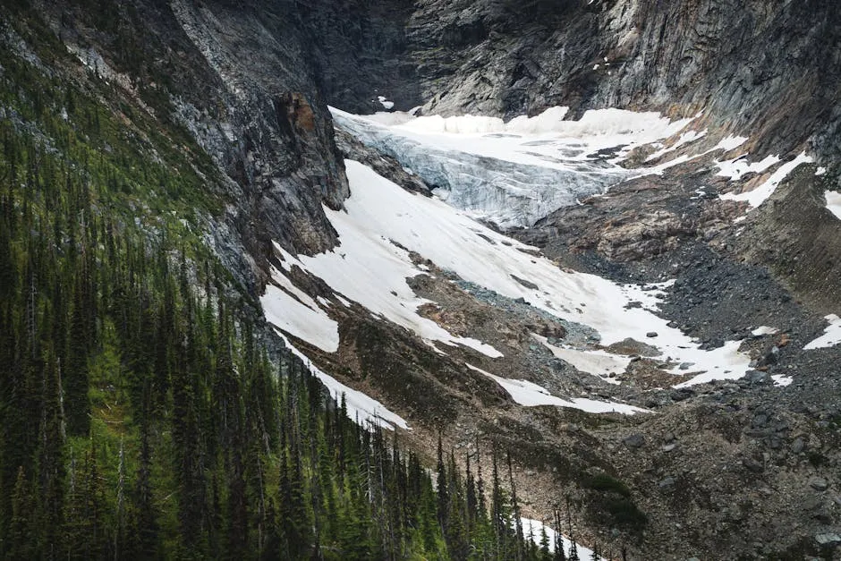
Grinnell Glacier, one of the most photographed glaciers in Glacier National Park, has retreated to the mostly shaded, upper confines of its basin. The USGS Repeat Photography Project began capturing the same vantage points from the same physical locations, and the visual results are stark. Upper Grinnell Lake has formed as the glacier has retreated, and the change in height of Grinnell Glacier along the cliff face hints at the volume loss over that timespan.
Studies of local topographic effects show that variations in glacier geometry, ice thickness, elevation, shading, input from avalanching, and the contribution of wind-deposited snow likely account for each glacier’s unique rate of change. Grinnell has been a particularly well-documented case precisely because it sits at a hikeable elevation – visitors have been photographing it since the early 1900s, creating an unbroken photographic record that no amount of modeling can replicate.
The Numbers Tell the Story – 1966 to Present
In 1966, there were 35 named glaciers in the park. By 2005, seven had shrunk below 0.1 square kilometers, leaving 27, and by 2015 there were 26 named bodies of ice large enough to be considered glaciers. That half-century comparison is among the most cited in all of American conservation science.
On average, the glaciers in the park have shrunk by roughly 39 percent since 1966. While the average loss was 39 percent, some glaciers have lost as much as 85 percent of their expanse over the past 50 years. All glaciers in Glacier National Park have decreased in area, though the rates of retreat are not uniform. The variation matters, but the overall direction does not waver.
Glaciers Breaking Apart – A 2023–2024 Finding
A study by the U.S. Geological Survey in late 2023 found that 11 glaciers in Glacier National Park have broken into pieces as climate change continues to warm the park. It has been expected for years that the park’s namesake glaciers would melt to a fraction of their former selves, and the study by Andrew Fountain, Bryce Glenn, and Christopher McNeil confirmed that glaciers continue to disappear across the West.
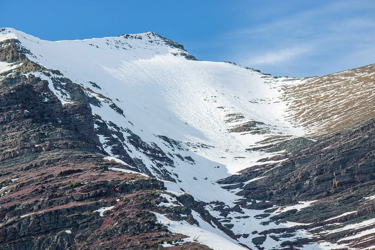
The team used high-resolution aerial photos taken from 2016 to 2020 and other imaging to complete the study. Several of the glaciers have been broken into pieces and are at the greatest risk of disappearing. Additionally, Boulder, Fissure, and Gray Wolf glaciers have been reclassified as perennial snowfields. That reclassification matters more than it sounds – a snowfield is not a glacier, and it does not function the same way ecologically.
Temperature as the Engine of Change
Analysis of weather data from western Montana shows an increase in summer temperatures and a reduction in the winter snowpack that forms and maintains the glaciers. Since 1900, the mean annual temperature for the park and the surrounding region has increased by 1.33 degrees Celsius, which is 1.8 times the global mean increase. That multiplier effect is significant – the park is not just warming with the planet, it is warming faster than most of it.
The rate of warming has spiked since 1980, with the park warming about 0.8 degrees Fahrenheit per decade since then. While the amount of precipitation in Montana hasn’t changed, warmer winters bring more glacier-eroding rain rather than glacier-forming snow. That shift from snow to rain during winter months is one of the subtler, but more damaging, changes in the system.
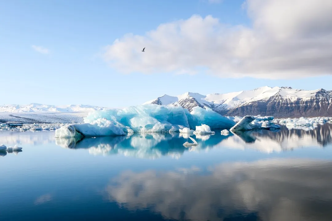
What the Meltwater Supported
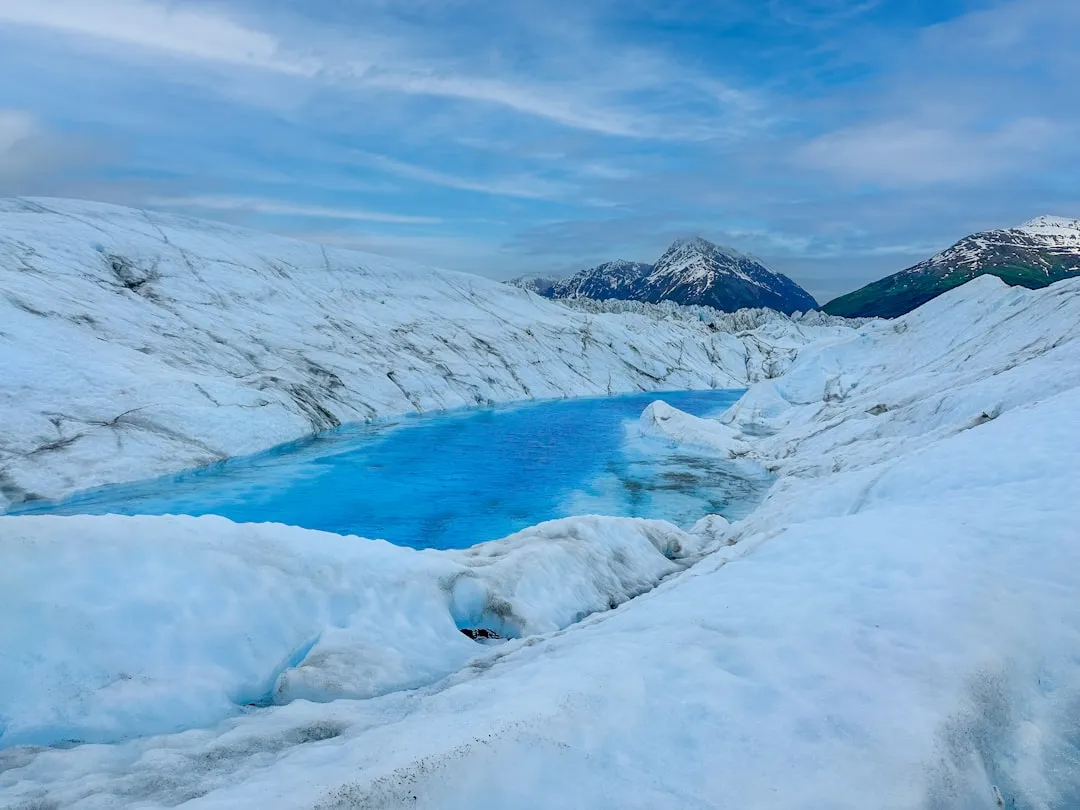
Glaciers play an important role in the park’s ecosystems, particularly in the summer months. They provide a source of cold, clean water as the runoff cools stream temperatures in the driest and hottest parts of the summer after seasonal snowpacks have vanished. Without that cold buffer, stream temperatures rise in ways that stress species adapted to near-freezing water.
The U.S. Fish and Wildlife Service added the western glacier stonefly and the meltwater lednian stonefly to the Endangered Species List, both under the designation of threatened. These insects exist only in the cold runoff streams fed directly by glacier melt. The park is considered a stronghold for a large diversity of plant and animal species and harbors some of the last remaining populations of threatened and endangered species such as grizzly bear and bull trout, as well as ecologically important species such as bighorn sheep and black bear.
Fire Joins the Picture
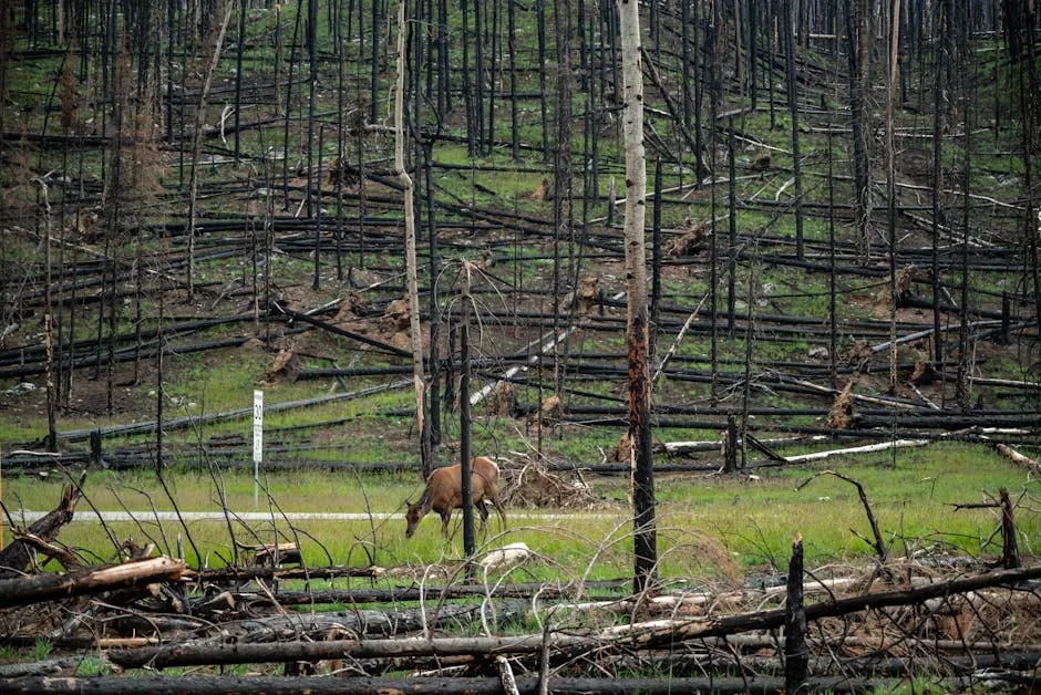
Ice and fire have become twin stories at Glacier. In the Northern Rockies, the earlier melt of snowpack has helped push fire frequency and severity upward, adding roughly 76 extra days to the fire season. In 2003, the most severe fire season on record in Glacier National Park occurred when 13 percent of the park’s one million acres burned.
Across the Northern Rockies, large wildfires are now ten times more common than they were in 1970, and they burn roughly 45 times more acreage than they used to. In the timespan captured by repeat photography, it is evident that Swiftcurrent Glacier has retreated while wildfire has consumed a patch of trees at the base of Swiftcurrent Mountain. That single image tells two stories at once – the retreat of cold and the advance of fire.
Visitation and a Closing Window
More than 3.2 million visitors passed through one of Glacier’s entrances in 2024, nearly 300,000 more than in 2023. It was just the fourth year the number of visitors has eclipsed 3 million and came close to the 2017 record of 3.3 million. Many of those visitors come specifically to see what may not be there for future generations.
The boost in recreation visits came outside of the traditional busy season, with Glacier recording all-time record numbers in May, as well as in September and October. There is an urgency written into those visitor numbers. March 2025 was designated the World Day for Glaciers as part of the UN International Year for Glaciers’ Preservation, driven by rapid and accelerating glacier loss. In 2023 and 2024, for the first time, all 58 reporting Global Reference glaciers had a negative mass balance. The park’s glaciers are part of a global reckoning, not just a regional one.
The Landscape Ahead – What Monitoring and Research Tell Us
The USGS Benchmark Glacier Project conducts glaciological research and collects field measurements across select North American glaciers, including Sperry Glacier in the park. These records provide direct evidence of glacier change, and the amount of future land ice lost depends on the trajectory of greenhouse gas emissions. That last point is the one that leaves the picture genuinely unresolved.
In 2024, Glacier National Park received over $1.9 million in funding from the Inflation Reduction Act to continue work on advancing bison reintroduction, inventorying cultural resources impacted by climate change, and protecting and restoring whitebark pine. The continued retreat and ice mass loss of small glaciers in the park is described by the USGS as certain – the open question is the rate. Meanwhile, researchers believe that between 2030 and 2080, some glacial ice in Glacier National Park will be gone unless current climate patterns reverse course.
Conclusion: A Living Archive
A visual timeline of Glacier National Park is also a document of scientific patience. The USGS photographers who returned to the same ridgelines year after year, carrying the same framing coordinates as photographers from 1911, were building something rare: an unbroken visual record of a landscape in motion.
Comparing photographs from the mid-19th century with contemporary images provides ample evidence that the park’s glaciers have retreated notably since 1850. What that evidence tells us is not just about ice. It tells us about water, wildlife, fire, temperature, and the relationship between a named place and the features that gave it its name.
The park will not vanish. Its mountains, lakes, and wild creatures remain extraordinary. But each summer that passes without restoration writes another frame into that timeline – one more image of exposed rock where ice once pressed. The archive keeps growing whether we look at it or not.
AI Disclaimer: This article was created with the assistance of AI tools and reviewed by a human editor.